
Engineering For Developments In Sydney's North West Growth Area
Shale, reactive clay and a stormwater system run largely by Sydney Water shape any development around Rouse Hill, Box Hill or Kellyville before the architect draws a line. Between them they decide the footings, the basement and a contribution that many developers in the area now have to budget for.
Much of this land was rural not long ago. Blacktown and The Hills councils both cover parts of it, so the rules also depend on which side of a road your site sits.
The ground across the north west
Most of this area sits on Bringelly Shale, part of the Wianamatta Group. Over the shale you find silty and highly plastic clay soils, and weathered shale can start only a couple of metres down in places.
That ground is very different to the sandstone of the CBD. Weathered shale digs more easily near the top and gets harder with depth, and the depth to good shale moves around from one borehole to the next, so foundation levels come from the investigation on each site.
Reactive clay and low-rise work
Near the surface, the clays swell when they get wet and shrink when they dry. Rafts and footings for townhouses and low-rise work are designed for that movement under AS 2870, with the details set out in [reactive clay sites and footing design in NSW](/blog/reactive-clay-sites-footing-design-nsw).
Waterlogging in wet seasons adds to it, since these soils are slow to drain. A site that looks firm after a dry month can be a very different site to work on after a wet one.
Salinity
Shales of the Wianamatta Group are a known source of salt, and salinity potential maps for Western Sydney show parts of the Rouse Hill area at a moderate level. Groundwater in the shale tends to be brackish to saline.
We test for it on each site rather than rely on the map, because it changes the concrete grade, the cover and the masonry in contact with the ground. The full picture is in [saline soils in Western Sydney](/blog/saline-soils-western-sydney-concrete-and-brickwork).
Old farm dams and fill
This one catches people out on former rural blocks. Old farm dams get filled and graded over, and a tidy paddock can hide several metres of uncontrolled fill and soft silt where the dam used to be.
A walkover and old aerial photos usually find them, and a borehole placed on the old dam confirms what it holds. Footings then go through it, or the material gets dug out and replaced as controlled fill. Finding it after the slab design is done is far more painful.
Sydney Water's stormwater system
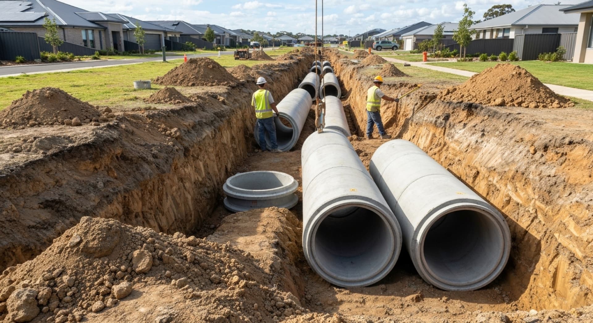
Across much of this area, Sydney Water owns and manages the trunk drainage: the creeks, large basins and channels that carry stormwater through the catchment. The Rouse Hill stormwater catchment takes in parts of suburbs including Box Hill, Kellyville, Kellyville Ridge, Beaumont Hills, Bella Vista, Castle Hill and Acacia Gardens, running to Cattai Creek through Caddies Creek, Smalls Creek and Second Ponds Creek.
That means your site's stormwater can have two authorities to satisfy, the council for local drainage and Sydney Water for the connection into its system. Connections to Sydney Water's waterways go through a Water Servicing Coordinator, a process discussed in [Sydney Water section 73 approvals](/blog/sydney-water-section-73-approvals-multi-unit-developments).
The Rouse Hill stormwater contribution
This is the recent change that matters most for feasibility. IPART ended the Rouse Hill Land Charge on 01/10/2025, and Sydney Water now recovers those costs through a stormwater Development Servicing Plan.
Its April 2026 plan sets the contribution per Equivalent Tenement, and the amount moves each financial year, so read the current figure from Sydney Water before you run the feasibility. Sites in the Kellyville and Bella Vista transport oriented area have their own stormwater requirements, so check the plan against your lot as well.
On-site detention
Paying into the regional system doesn't always remove on-site detention. Sydney Water's plan says on-site detention and controlled discharge remain required so that a development doesn't damage council or Sydney Water systems.
Some precincts rely on regional basins, and sites there have been given temporary detention until the basin downstream is connected. Your consent conditions and the local precinct plan decide which case you are in.
Low-lying land next to the creeks can also be flood affected, which sets floor levels and evacuation questions of its own.
Sites near the Metro
Taller buildings are arriving around stations such as Rouse Hill and Tallawong, and sites close to the line bring Sydney Metro's own requirements into the excavation and the piling. The approach is in [working with Sydney Metro](/blog/working-with-sydney-metro-engineering-requirements). Basement shoring in weathered shale then has to work with the rock joints and any seepage that follows them.
How we approach it
We check the catchment, the council and the Sydney Water position at the start of a job, along with old aerial photos of the site. Our civil, geotechnical and structural engineers then work from one ground model, so the clay, the salt, the dam and the detention tank all land on the same set of drawings.
New suburbs look like a clean slate from the road, but the ground and the catchment already have a long list of conditions.
ACSES provides civil engineering in Rouse Hill and across Sydney's north west. Talk to us about a project.
Building Relationships Beyond Structures

Related Articles
Tell us about your project.
We will respond with a clear understanding of how we can assist.
Partner With Us